WEATHER ALERT
ENVIRONMENT CANADA
*************************
Severe thunderstorm watch continued for:
Elliot Lake - Ranger Lake, Ont. (049200)
Gogama - Foleyet, Ont. (049620)
Kirkland Lake - Temiskaming Shores - Temagami, Ont. (049700)
Blind River - Thessalon, Ont. (049910)
Manitoulin Island, Ont. (049930)
Severe thunderstorm watch ended for:
Sault Ste. Marie - St. Joseph Island, Ont. (048830)
Chapleau - Missinaibi Lake, Ont. (049610)
Current details:
Conditions are favourable for the development of severe thunderstorms that may be capable of producing strong wind gusts and large hail.
Hazards:
Wind gusts near 90 km/h.
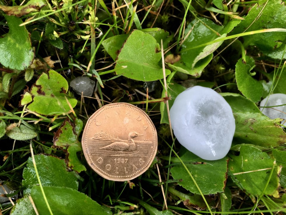
Up to nickel sized hail.
Timing:
Continuing into early this evening.
Discussion:
Thunderstorm development continues over northeastern Ontario. Some of these thunderstorms may become severe with strong wind gusts and hail as the primary threats. Thunderstorms are slowly weakening while moving east.
Large hail can damage property and cause injury. Strong wind gusts can toss loose objects, damage weak buildings, break branches off trees and overturn large vehicles. Locally heavy rain is also possible. Remember, severe thunderstorms can produce tornadoes.
Lightning kills and injures Canadians every year. Remember, when thunder roars, go indoors!
Emergency Management Ontario recommends that you take cover immediately if threatening weather approaches.
Severe thunderstorm watches are issued when atmospheric conditions are favourable for the development of thunderstorms that could produce one or more of the following: large hail, damaging winds, torrential rainfall.
Please continue to monitor alerts and forecasts issued by Environment Canada. To report severe weather, send an email to ONstorm@ec.gc.ca or tweet reports using #ONStorm.
For more information: https://www.ontario.ca/page/be-prepared-emergency.
More details on the alert are available here.
*************************